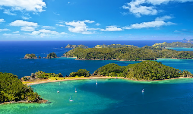
The Bay of Islands is an area on the east coast of the Far North District of the North Island of New Zealand. It is one of the most popular fishing, sailing and tourist destinations in the country, and has been renowned internationally for its big-game fishing since American author Zane Grey publicised it in the 1930s.
It is 60 km north-west of the city of Whangarei. Cape Reinga, at the northern tip of the country, is about 210 km by road further to the north-west. The bay itself is an irregularly-shaped 16 km-wide, 260 km2 drowned valley system and a natural harbour. It contains 144 islands, of which the largest is Urupukapuka, and numerous peninsulas and inlets. The three largest inlets are Waikare Inlet in the south, and Kerikeri and Te Puna (Mangonui) inlets in the north-west.
The Purerua Peninsula, north of Te Puna Inlet, separates the north-western part of the bay from the Pacific Ocean, and Cape Brett Peninsula extends 10 km into the ocean at the eastern end of the bay. The biggest town is Kerikeri, followed by Paihia. The small town of Russell is located at the end of a short peninsula that extends into the bay from the southeast.
This post is part of the Our World Tuesday meme,
and also part of the Travel Tuesday meme,
and also part of the Wordless Wednesday meme.


Wow - so gorgeous!
ReplyDeletePicturesque.
ReplyDeleteWorth a Thousand Words
I miss emerald water like this. Beautiful picture.
ReplyDeleteBeautiful islands ... and the picture serves them well too ;-)
ReplyDeleteSo beautiful..
ReplyDeleteOh My God, that view is incredible. How so beautiful. How far is the travel from Auckland Central?
ReplyDeleteWow! Beautiful landscape!
ReplyDelete